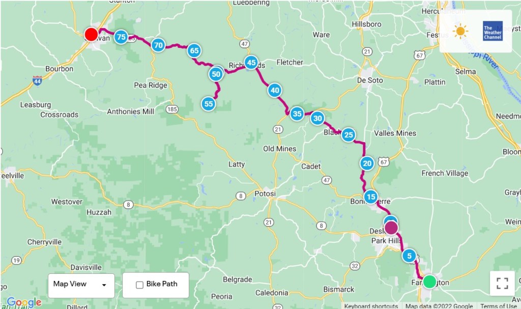
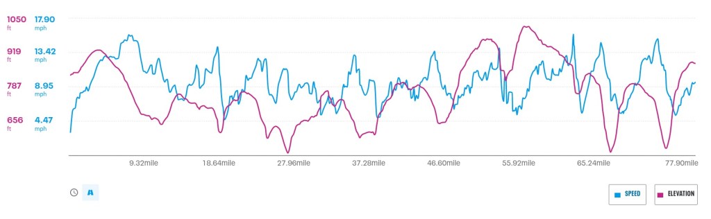
Farmington, Missouri to Sullivan, Missouri – 77.9 Miles
Riding in the hills of Missouri will beat you up. A day ago, I watched four other cyclists arrive at the hostel in Farmington after a long day on the road, and each of them looked like they’d just been rescued days after their ship went down. Slow moving, slow talking and baked from the heat, it wasn’t an encouraging sight for anyone thinking about touring Missouri by bicycle.
The temperature has been in the mid-90’s to over 100 degrees every day I’ve been in the state, and the heat index is typically over 100. That’s uncomfortable enough on a road bike carrying no load, but what’s it like on a touring bicycle with 40 pounds of gear while climbing steep hills? It kind of sucks.
As I mentioned in an earlier post, flat roads have been a rarity since I left the southernmost part of the state. As I ride, I’m either going up or down constantly. The downhill sections can occur at any time, although I have a general idea that something might happen based on how much climbing I’ve done over the past several miles.
There are three types of descents that I’ve experienced. The first is the gradual downhill. This doesn’t get the speed up too much and allows me to relax a little as I steer the bike.
The second is the more extreme version. You know when it hits because the bike accelerates quickly as the wind noise in your ears increases rapidly. In this situation I’m approaching 40 mph and very conscious of bike handling and what’s in front of me. I should mention that since I sent home some extra belongings and redistributed the weight down low on Ishmael, performance has improved significantly. Ishmael is more stable and less twitchy (oversensitive to steering corrections), which is welcome.
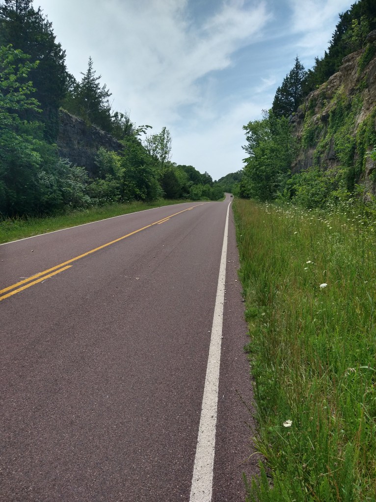
The third type of downhill experience is the extreme descent combined with curves, unknown road conditions and traffic. When the acceleration begins, it’s like being pulled by a strong magnet toward the bottom of the hill. On a straight road with a good sight line, it’s easier to see something that might be a problem. When the road curves and the bike is doing over 35 mph, things can change fast. Cars will roll over sticks, rocks and holes in the road. Bikes aren’t that forgiving. While trying to see and avoid road hazards, I’m always looking for traffic, particularly on corners. I don’t want to see a truck crossing the centerline on the way down!
Another hazard is a decreasing radius curve, which starts out gradually, but gets sharper once you’re in it. If this happens with too much speed, you’ll have to slow down immediately or will likely be heading off the road quickly. On downhills like this, I have a speed I’m comfortable with for the conditions and will grab the brakes when that speed is exceeded. The good news about any descent is that it’s effortless and the cooling effect of the air is refreshing. It’s a nice break from what I know is coming next.
Climbing hills can be fun. On a gradual uphill, in the right gear, it’s almost indistinguishable from riding on flat ground. The effort put into the pedals is low and the speed is acceptable. These are the kind of climbs I’ve encountered most riding on 4-lane highways. Elevation differences on highways are smoothed out, and what’s left is a road that’s not too extreme, up or down. On the back roads of Missouri, it’s different.
The next category of climb is the short, steep uphill, maybe about a quarter mile long. If I’ve just flown down a hill to get to the start of this, that’s when time starts to slow down. Ishmael has a mid-range low gear and a low-range low gear. In Alabama and Mississippi, I never needed to use the lowest (easiest) gear because the hills didn’t require it. I had enough power to overcome them, and it wasn’t a problem.
When I start up a hill, the first thing I notice is how much force I have to put into the pedals. Ishmael’s weight is predominately in the rear, so that’s felt as drag wanting to hold me back. On a short, steep climb I can decide whether to use more power to get over it faster or shift down to a lower gear and ride up slowly, but with less perceived effort. In either case, since the speed has dropped to about 6 mph or less, the air that was moving past at higher speeds isn’t there, which means I’m putting in a lot of effort with minimal air flowing past. This is when, as they say, things can heat up quickly. Sweat starts to drip, and because the humidity is high there’s very little cooling effect. After a few minutes of hot, hard effort, I’m at the top and appreciating flat ground.
The worst hills are the long, steep, and I should say “unexpected”. By this I mean when I turn a corner and what looks like a mountain is in front of me, that’s discouraging. First thoughts are typically “How am I going to get up that?” or “It’s a good time to take a break”. Once the climbing begins, there’s no rest. Everything that happens on a short, steep hill is multiplied, with the effect of wearing the body and mind down along the way. The practical solution to get up some of these abominations is to use the lowest gear on the bike. That sounds doable, but if the hill is extreme a high level of effort results in about 2 mph forward progress. So, for five or ten minutes I’m climbing very slowly, swaddled in a blanket of hot, humid air and doubting whether I’ll ever visit Missouri again on a bicycle. There is the benefit of the fast downhill to follow, but that leads to the next uphill, and, you know…..
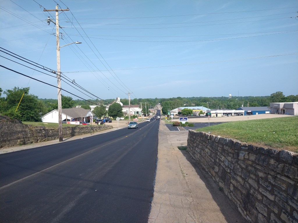
When I checked out of Al’s Place this morning at 6:30 the air was already warm. The Sun was just rising, but I could tell it was going to be a hot day. Sullivan, Missouri was the destination, which would put me in line with Washington, Missouri and the start of the Lewis and Clark Trail. Rather than follow the Adventure Cycling route out of Farmington, I jumped on Highway 67 and rode 12 miles north to Bonne Terre for breakfast. When I stopped at Hardee’s, a group of men asked me some questions about the trip. I mentioned the Missouri heat and hills, and one guy said, “It’s going to get a lot steeper where you’re heading”. Call this “foreshadowing”.
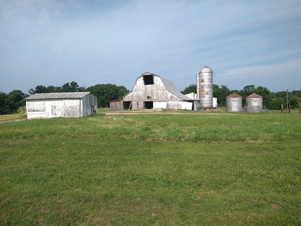
It wasn’t long before I was in the country. Unfortunately, there were no stores shown on the map for 20 miles, so I loaded up with supplies before I left town.
This was actually a nice set of hills. I built enough downhill speed on the first one to get over the next two.
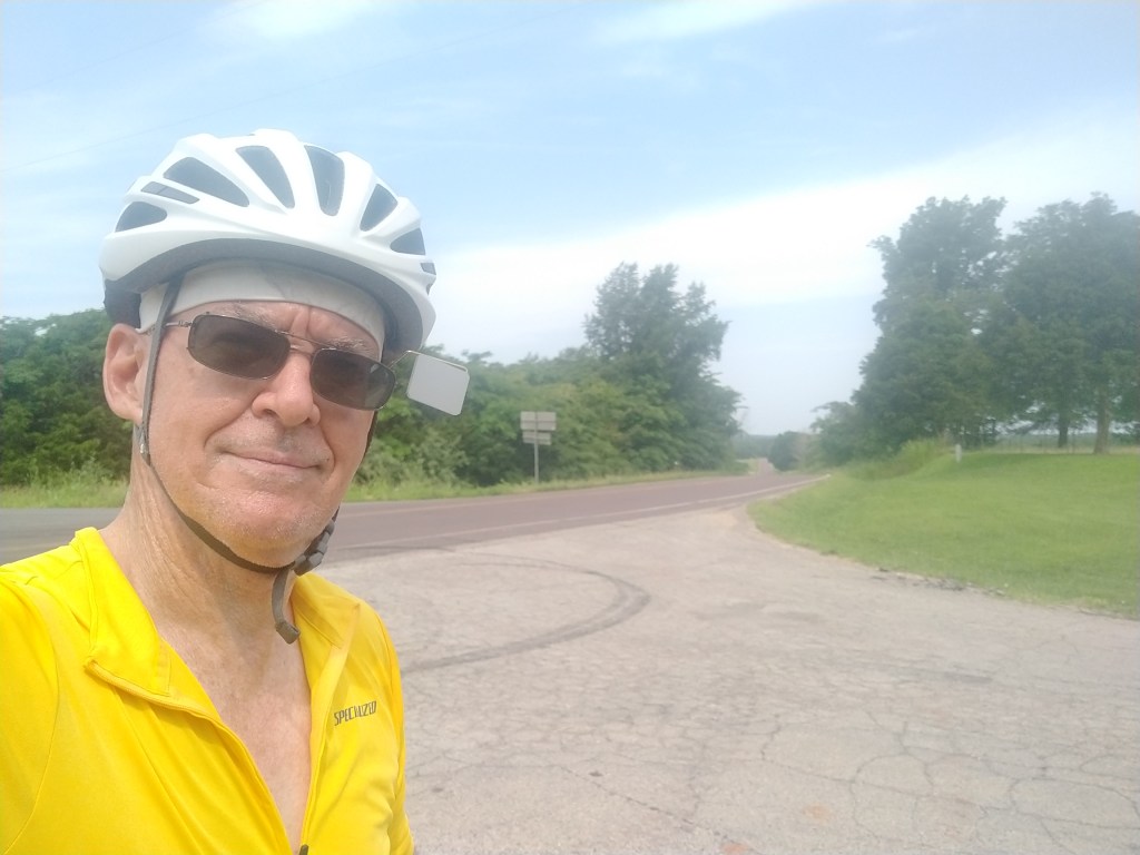
I was wearing a new jersey today and thought it gave me that Tour de France look.
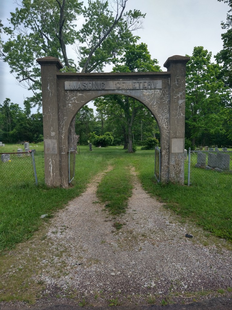
It was pure rural riding for a couple of hours, but I did discover the place where Masons go to rest.
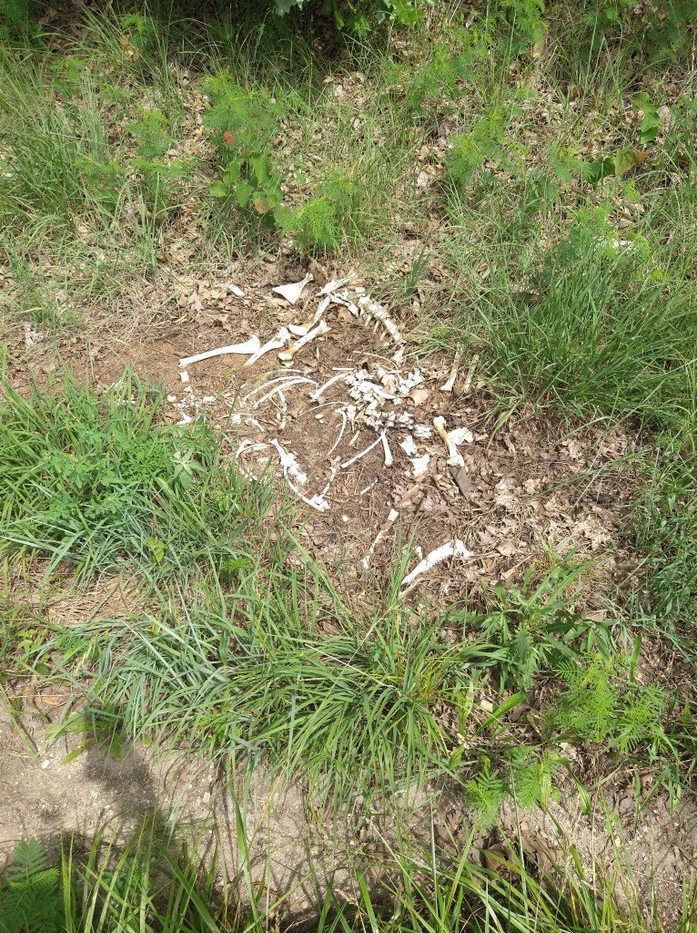
Later, by the side of the road, I viewed the aftermath of a hit-and-run accident. I saw several deer and heard others crashing through the woods as I went by. Probably waiting for the next car.
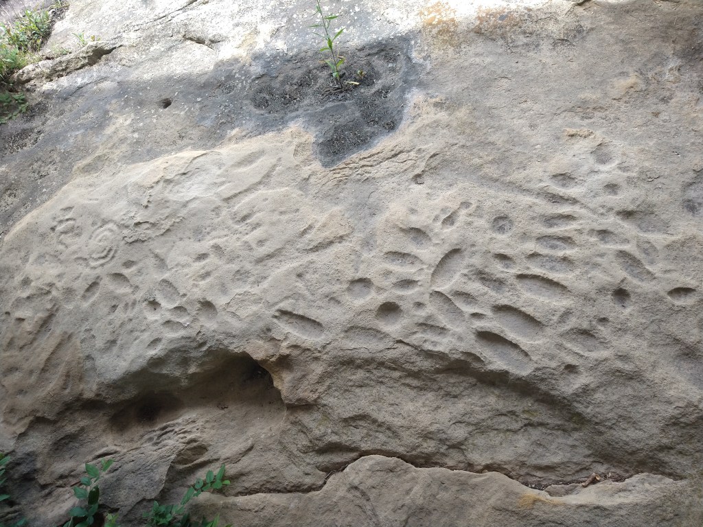
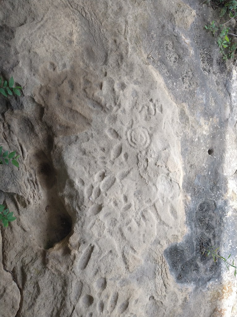
I passed by Washington State Park and continued down the road to grab some food at a Dollar General. A woman who worked at the park was there and asked about the trip. She suggested that it would be worth seeing some Native American petroglyphs nearby, which were about a mile down the road. These are rock carvings made by early inhabitants between 500 and 2,000 years ago. There’s no way to accurately date them since the rocks are ancient, but the subject of the carving can be linked to a specific time period. Thinking about someone carving images into stone 500 or more years before I stood there with Ishmael was hard to grasp. The people who made the images could never have imagined our world, and I doubt we could imagine the world of 2522.
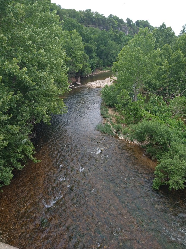
After some food and drink, it was back to pedaling. The scenery was mostly forest, but streams occasionally appeared.
Traffic thinned out and the road was clear. I was making good time.
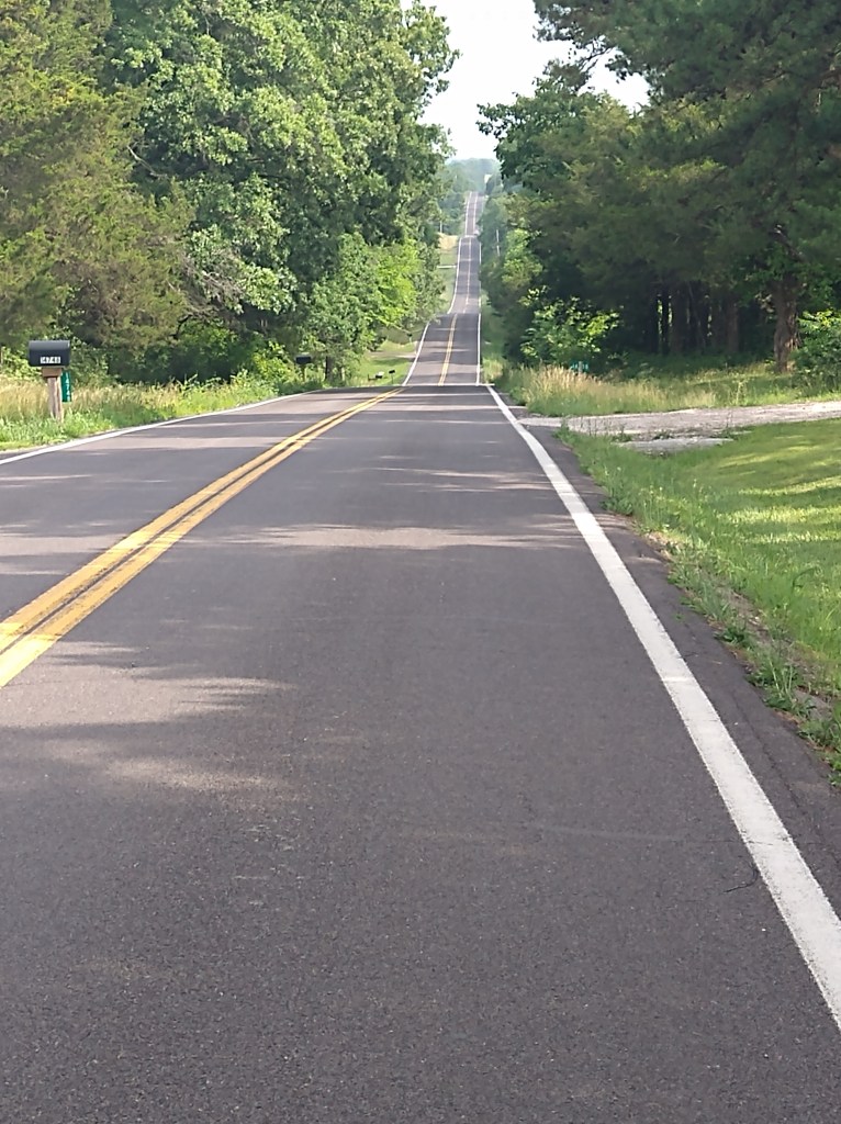
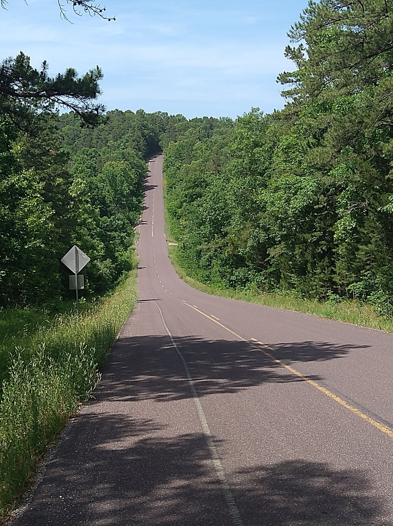
I encountered a series of uphills and downhills that came quickly. The one in the back of the picture was one of the steepest of the day, and I climbed its counterpart immediately after the descent.
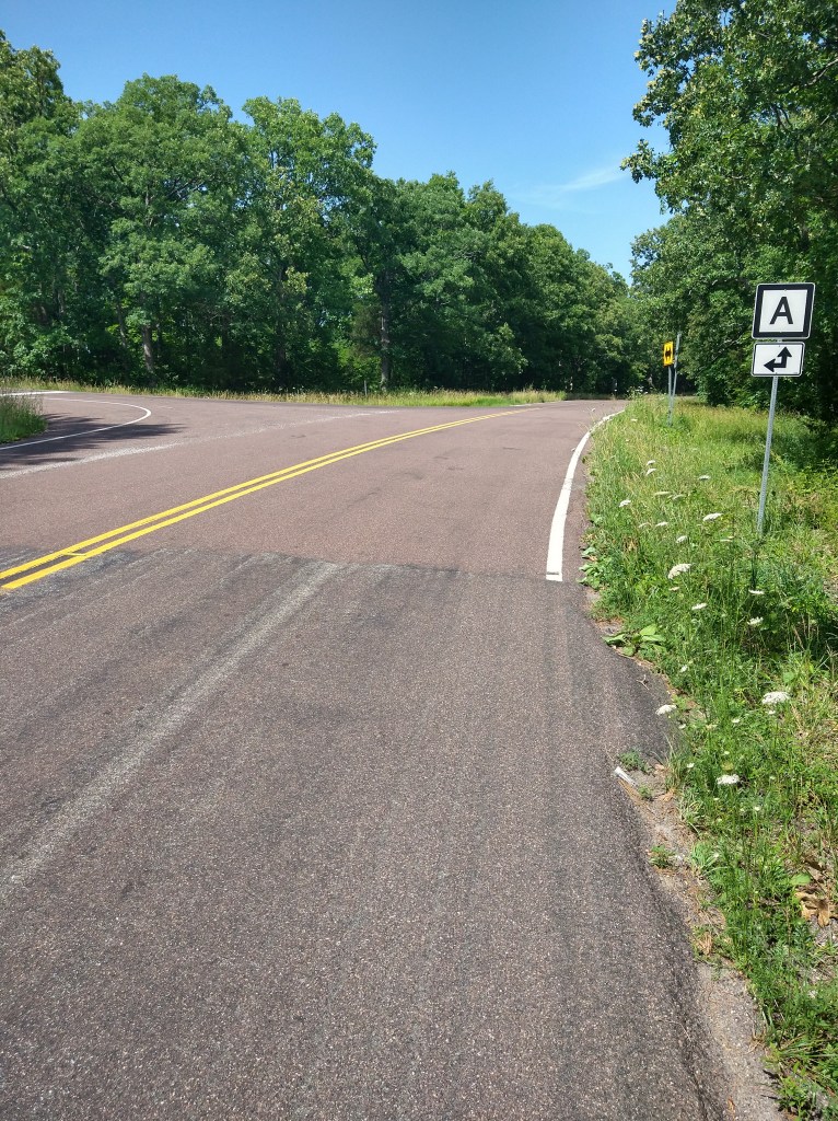
After reaching the top, I pulled off to the side for a navigation check. Since I had no paper map for this section of the route, I was relying on the ACA Navigator app for direction. The route is shown in purple, with a blue dot continuously indicating the rider’s position relative to the course. When I looked at the app, my blue dot was about an inch away from the line. This Was Not Good. A quick calculation showed that I was 5.1 miles off the route after just descending and climbing the most significant hills of the day. I looked around for someone to blame but was the only one there. After checking Google Maps for an alternate route and finding an undesirable dirt road of questionable value, I decided that I didn’t want to deal with it.
So, there was no choice but to retrace the five miles I’d just ridden and revisit the same hills in reverse order. This cost me an hour in time and 10 miles in distance, on a day when I hoped to be in the hotel early. When I got back to the junction I’d missed, I saw that state road “A” has a 90-degree bend in it, while what was state road “A” runs directly into state road “H”. I didn’t see that coming from the east, but it was displayed from the west.
The day wasn’t over yet. I tried not to dwell on the fact that I could have been done while I was still pedaling 10 miles away from Sullivan. Traffic was increasing again on a no-shoulder road, and the hills were back. To irritate me just a bit more, there were two significant climbs in the last few miles which I could have done without.
Finally, I reached the hotel after 5:30 and over eight hours of riding later. I walked over to Cracker Barrel and loaded up on dinner choices, which is always a cure for most of life’s temporary irritations.

Kevin, I’ve heard from several TranAm cross country riders that the hills in Missouri were the worse, worse than the Rockies and the Appalachians. Good on you for pushing through!
LikeLike
That sounds familiar. Never fun when you miss a turn on a hot day, having to backtrack and climb those same hills a second time.
LikeLike
You’re doing great. Kudo’s for keeping a good attitude even in Missouri hills. Thankfully, you are not riding back home and going through them “all” again. Take care, and enjoy your weekend.
LikeLike
I’ve riden some of those roads in SE Missouri. I know the feeling of turning a corner and seeing yet another set of hills. And of course only looking down to put it out your mind. You are doing well at 70 plus miles a day. You are heading into the plains so things will get better. Love the blog.
LikeLike